Address
Commissioner Secretariat, Main RCD Road Khuzdar, Balochistan
info@commissionerkalat.gob.pk
Phone No
+92 848 000 0000
Fax: +92 0848 111 1111
Office Hours
Monday-Friday: 9AM to 5PM
Sat-Sun- OFF
| District Headquarter | Mastung |
|---|---|
| Date of Notification | 1991 |
| Population (2023) | 313,271 |
| Area | 3,308 km2 (1,277 sq mi) |
| Religion | Muslim 97.05% Hindu 2.42% Christians 0.37% |
| Languages | Brahvi 89.05 % Balochi 7.19 % Sindhi 2.12 % |
| Tehsils (03) Sub Tehsil (01) | Mastung, Dasht, Kardigap Khadkucha (ST) |
| Union Councils | 53 |
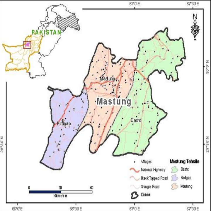
Mastung District is located between 29° 20′ 13″ to 30° 15′ 8″ north latitudes and 66° 11′ 34″ to 67° 25′ 59″ east longitudes. It is bordered to the north by Quetta district, to the east by Sibi and Bolan districts, to the south by Kalat district, and to the west by Chagai district.
Etymology of term Mastung
The name “Mastung” derives from two Brahui words: Mas, meaning “mountain,” and Tung, meaning “hole.” The name reflects the district’s geographical setting, as it is situated at the base of Lak Pass. The journey through Lak Pass from Quetta to Mastung feels like passing through a hole, which inspired the name “Mountain Hole.”
Although the Ahmadzai Khans of Kalat once attempted to rename the district to Khudabad, the original name Mastung has remained in common use.
1. Early Administrative Division Mastung was the central town of Sarawan, the northernmost division of Kalat State, with Jhalawan being the southernmost division. During British colonial rule, administrative divisions were based on the people rather than the land, with Mastung and Kalat being managed directly by the Khan of Kalat, while other areas were governed by tribal leaders.
2. Early History The early history of Sarawan is somewhat obscure, particularly before the Ghaznavid conquest around 977 AD. Local traditions suggest that a Hindu dynasty named Sewa, part of the Rai Dynasty of Sindh, ruled the region in the 7th century AD. The area was known as Kalat-i-Sewa during this period.
3. Muslim Rule and Regional Changes By the 7th century, Muslim dynasties began to rule Balochistan. The Arabs captured Khuzdar, a significant town in Jhalawan, in 664 AD and expanded their control. Muhammad bin Qasim’s invasion in 711 AD ended the Hindu dynasties, including the Sewa dynasty. The Arabs ruled until the rise of the Ghaznavid dynasty in 977 AD, which was later succeeded by the Ghorid Dynasty in 1202 AD. In the late 14th century, the Kandahar Kingdom under Amir Timur (Tamerlane) took control of Mastung, and his grandson, Pir Muhammad, managed the region.
4. Mughal Influence After the Timurid dynasty ended in 1470, the Arghuns ruled until 1530. During this time, the Baloch expanded their influence, taking control of Kalat in the 15th century. The Brahuis consolidated the region into a unified state under the Ahmadzai Khans of Kalat. The Mughals later took over from the Arghuns, and Mastung became part of the Kandahar Sarkar between 1530 and 1545, ruled by Mirza Kamran Khan. Emperor Humayun briefly camped in Pringabad near Mastung in 1543 and had to flee, leaving his infant son Akbar behind. Mirza Askari, who cared for Akbar, took him to Kandahar. Upon Humayun’s return, he regained control over Kandahar and Mastung.
5. Brahui and Mughal Decline As Mughal power declined, the Brahuis gained prominence in Mastung. For twelve generations, they enjoyed semi-independence until Mir Ahmed, a Brahvi, acquired Mastung from the Mughal Governor and made it the capital of Kalat State from 1666 to 1695.
6. 18th and 19th Century Changes Under Nadir Shah of Iran (1736-1747), Mastung remained the capital of Kalat. After Nadir Shah, Ahmad Shah Abdali defeated Mir Muhabat Khan in 1758, and Mir Nasir Khan, known as “The Great,” became the ruler of Kalat State. Nasir Khan’s support in various campaigns earned him regions including Quetta, Mastung, Harrand, and Dajal. The Brahuis retained control until the British conquered Kalat in 1839.
7. British Rule and Modern Changes During the British conquest, Khan Mehrab Khan and several chiefs were killed. The British appointed Mir Shahnawaz Khan as Khan, but Sarawan and Kach Gandava were annexed to Kabul and administered by British officers until their restoration to Kalat in 1842. Following a rebellion, Mir Nasir Khan II was placed on the throne with British support. In 1854, a treaty allowed the British to build railway and telegraph lines through Kalat.
8. Integration into Pakistan In 1948, the Khan of Kalat acceded to Pakistan. The State was merged into One Unit in 1958 and became part of West Pakistan. After the dissolution of One Unit, Kalat and Mastung were incorporated into Balochistan Province. Mastung was officially made a separate district from Kalat in 1991.
Historical Sites:
Fort of Emperor Akbar: This Mughal-era fort is an important historical landmark that reflects the architectural prowess of Emperor Akbar’s era. It stands as a testament to the region’s rich history and requires preservation efforts from the Government of Balochistan (GoB).
Shrine of Hazrat Muhammad Sheikh Taqi Noorani: This shrine is a significant spiritual site and holds historical value. Its preservation is crucial for maintaining the cultural heritage of the region.
Tourism and Picnic Spots:
Hazarganji Chiltan Park: A popular picnic spot, this park offers scenic beauty and is ideal for family outings. It features lush landscapes and is a great place to relax and enjoy nature.
Dasht-e-Khumbaila: Known for its stunning natural beauty, this area is adorned with colorful flowers, majestic mountains, waterfalls, and serene lakes. It’s a year-round destination for nature enthusiasts and offers breathtaking views.
Koi Amach and Dasht-e-Omar Door: These areas are renowned for their picturesque landscapes, including vibrant flora, high mountains, and tranquil lakes. They provide excellent opportunities for sightseeing and outdoor activities throughout the year.
Lak Pass: Offering panoramic views of the surrounding hill ranges, Lak Pass is a scenic spot that captures the natural beauty of Mastung. It’s an excellent location for those who appreciate stunning mountain vistas.
Each of these sites and spots not only adds to the historical and cultural richness of Mastung but also offers visitors a chance to explore its natural beauty. Developing and preserving these locations can significantly enhance tourism and promote local heritage.
Topography:
Mastung District is characterized by its rugged and mountainous landscape. The region is dominated by a series of parallel ridges running north to south, with numerous valleys in between. These valleys, with elevations ranging from 1,524 to 1,981 meters above sea level, are surrounded by significant mountain ranges.
Central Brahvi Range: This range covers a large portion of Mastung, featuring prominent peaks like Murdarghar (3,265 meters) and Kuk Ghar (3,250 meters) in the northeast. The Zarakhu Valley is nestled among these peaks.
Nagau Range: Located further south, these hills reach heights above 2,500 meters.
Koh-i-Siah Hills: Stretching along the southern boundary of Dasht Tehsil, these hills are noted for their black appearance, with the highest peak reaching 3,117 meters.
Zahri Ghar Mountains: Running from northeast to southwest, these mountains divide Mastung into two parts, with Koh-i-Zindan being the highest point at 2,681 meters. The famous Nishpa Tunnel, a 1.5 km long passage for the Quetta-Mastung-Zahidan Railway, is also located here.
Chiltan Hills: Extending from the northwest of Zahri Ghat, the highest peak in this range is 3,314 meters.
Mashlakh Range and Unalath Range: Located near the Mastung-Quetta border and southwest of Mastung Valley respectively, these ranges include the Unalath Range with a highest peak of 2,422 meters.
Garr Hills: Running along the boundary with Chagai District, west of Kirdgap Valley.
Rivers, Streams, and Lakes:
Major Rivers: Shirin Aab flows from north to south in the western part of the district, while Parri River runs near the southeastern boundary.
Other Streams and Torrents: Includes Kangoi Jhal, Chunka Dhor, Bhalla Dhor, Zarakhu Nala, as well as intermittent streams like Sar-i-Aab, Jal Pash Karm, Takri, Siah Band, and Zalo.
Lakes: There are no significant lakes in the district.
Forests:
Mastung’s forest cover is limited, predominantly featuring Balochistan Dry Temperate Scrubs (Steppe) Forest. A small area is conserved as State Forest and Wildlife Protected Areas, including:
Major tree species include Turkestan juniper (Juniperus excelsa polycarpos), wild ash (Fraxinus xanthoxyloides), and kakrasinghi (Pistacia khinjuk). Key shrubs are wild almond (Prunus ebernea), silverleaf cotoneaster (Cotoneaster spp.), sea wormwood (Artemisia maritima), and joint pine (Caragana ambigua). Ground cover includes grasses like Stipa himalacia and Dichanthium annulatum.
Soils:
The soil in Mastung is predominantly limestone and clay, characterized as moderately deep, strongly calcareous, and gravelly clay loam, making it quite fertile.
Climate:
Mastung experiences extreme weather conditions:
Summer: From mid-April to mid-September, with July being the hottest month. Average temperatures range from 36°C (max) to 20°C (min).
Winter: From mid-September to mid-April, with December to February being particularly cold. January is the coldest month, with temperatures ranging from 11°C (max) to -3°C (min).
Precipitation: Rainfall is sparse, averaging 200 mm annually, with most precipitation occurring during the winter months from January to March. Snowfall is also common.
Seismic Activity:
Mastung is located in Seismic Zone 3 of Pakistan, indicating moderate to severe potential damage from earthquakes.
Uphill Steep Rocky Cliffs:
In the steep, rocky areas such as Chiltan, Koh-e-Haider, Ab-i-Gul, and Zarighat Hills, the vegetation is dominated by:
Foot Hills:
These fertile plateaus, such as Dasht-e-Baddo and Gayawan, serve as grazing lands and feature:
Piedmont Plains:
These modified plains are used for agriculture and feature:
Dry Stream Beds:
Common in the district, these beds are often populated by:
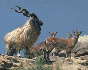
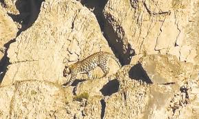
Mammals:
The district is home to a variety of mammals, including:
Birds:
Birdlife includes:
Reptiles and Amphibians:
Notable species are:
Mastung District features several wildlife sanctuaries that protect its diverse fauna:
These areas provide sanctuary for:
This diverse and rich ecosystem makes Mastung a crucial area for conservation and wildlife protection.
Agricultural Zone:
Mastung district falls within the Tropical Agro-Ecological Zone of Balochistan, characterized by its diverse agricultural activities adapted to the region’s climate.
Crops:
The district supports a range of crops, including:
Fruits:
Mastung’s agriculture also includes a variety of fruits:
Vegetables:
The district is known for its extensive vegetable cultivation, producing:
These crops and produce highlight Mastung’s agricultural diversity and its role in supporting the local economy and food supply.
In Mastung district, traditional handicrafts are primarily crafted by women in their homes. These artisanal works include:
Embroidery: Elaborate stitching adorns various garments and accessories, including:
Carpets: Handmade carpets, often featuring intricate designs, are a significant part of the local craft tradition.
These handicrafts reflect the cultural heritage and artistic skills of the local community, adding both functional and decorative value to daily life.


Commissioner Secretariat, Main RCD Road Khuzdar, Balochistan
info@commissionerkalat.gob.pk
+92 848 000 0000
Fax: +92 0848 111 1111
Monday-Friday: 9AM to 5PM
Sat-Sun- OFF
© All Rights Reserved. Commissioner Kalat Division

Typically replies within an hour