Ancient and Medieval History
- Alexander the Great: Alexander the Great is recorded to have passed through Lasbela in 326 BC during his retreat from India. He traveled through Makran and Lasbela before returning to Greece.
- Seleucus Nicator and Chandragupta Maurya: After Alexander’s death, Seleucus Nicator ruled the region until 305 BC, when he was defeated by Chandragupta Maurya, who then acquired Lasbela and other regions.
- 7th Century AD: The town of Bela was ruled by a Buddhist ruler, Somani, a descendant of the Rai dynasty of Sindh. Raja Chach of Sindh marched to Bela in 636 AD to demarcate boundaries.
- Muhammad Bin Qasim: In 712 AD, Muhammad Bin Qasim passed through Lasbela on his way to conquer Sindh. The region was under the control of Muhammad Ibn Haroon, who died in Bela. The Arabs’ influence persisted until the end of the 10th century.
Medieval Period
- Soomras and Sammas: The Soomras rose to prominence in the 11th century, but were eventually replaced by the Sammas in 1333. The Sammas ruled until 1523 when Shah Hussein Arghun defeated them.
- Local Tribes: The Gujar, Ranjha, Gunga, and Burfat tribes held semi-independent power before the rise of the Aliani family of the Jamoot tribe, who established the Lasbela State.
Rise of the Jamoot Family
- Jam Ali Khan I (1742-1766): Established control over Bela in 1742 with the assistance of Muhabbat Khan, Khan of Kalat.
- Subsequent Rulers:
- Jam Ghulam Shah (1765-1776): Died in Kalat; remains interred in Bela.
- Jam Mir Khan I (1776-1818): Expanded influence.
- Jam Ali Khan II (1818-1830): Continued the lineage.
- Jam Mir Khan II (1830-1869): Known for his resistance against the Khan of Kalat, ultimately acknowledging his sovereignty.
- Jam Ali Khan III (1869-1896): Managed internal affairs with British oversight.
- Jam Mir Kamal Khan (1896-1921): Ruled until the formation of Pakistan.
Princely State and British Era
- Pre-Partition Era: Lasbela was a Princely State under a subsidiary alliance with the British Government. It maintained its status as a Princely State with Pakistan following Partition in 1947.
- One Unit Scheme: In 1955, Lasbela, along with other Princely States, was merged into West Pakistan as part of the One Unit Scheme, which consolidated the provinces into a single administrative unit.
Modern History and Accession to Pakistan
- 1950s: The Balochistan States Union was established in 1952, incorporating Kalat, Lasbela, and Makran. In 1955, under the One Unit Policy, West Pakistan was formed, and the Balochistan States Union was dissolved.
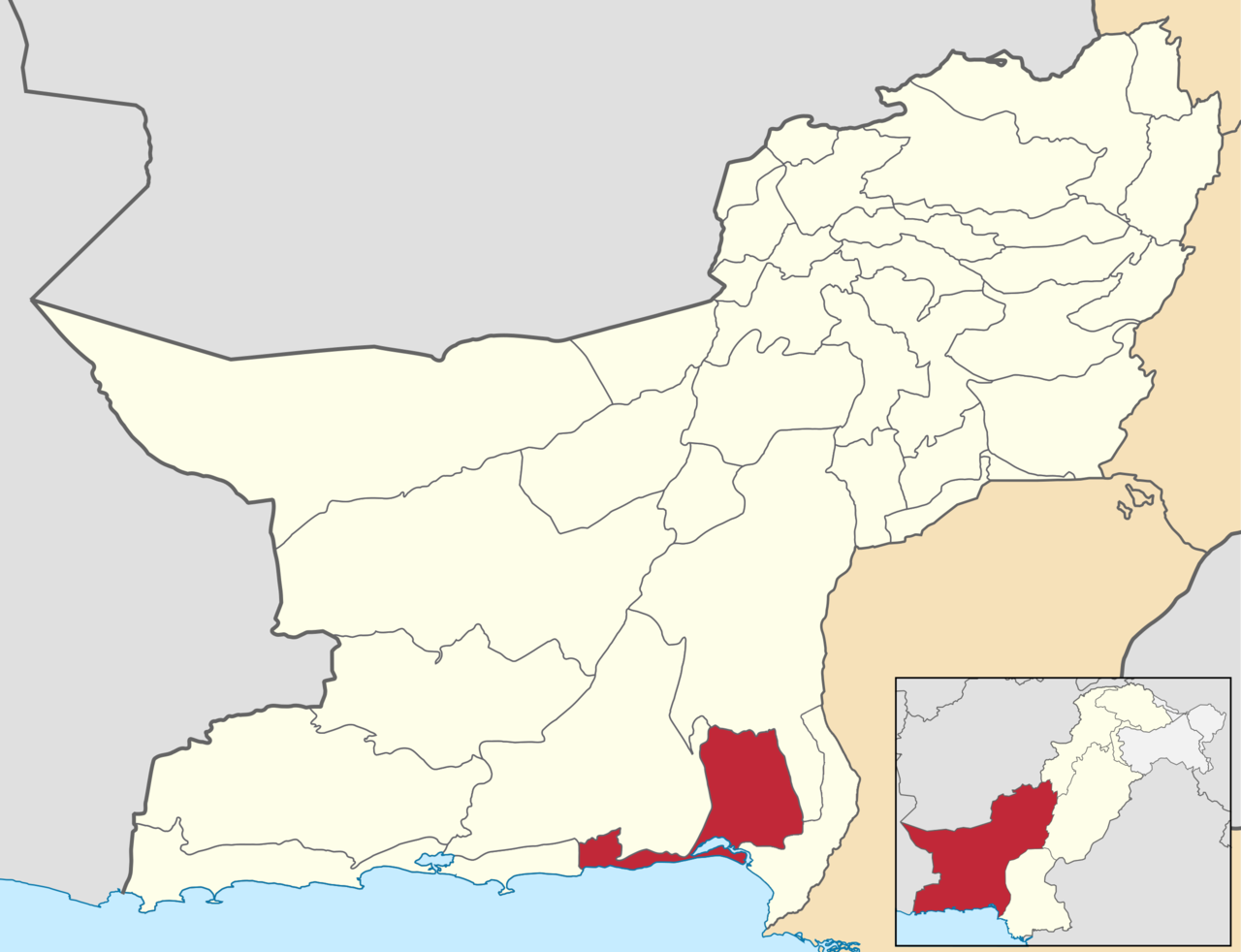
- Post-1955: Lasbela was re-organized into a separate district in December 1960 and was part of Karachi Division until the 1970s, when it was transferred to Kalat Division.
Statement on Accession to Pakistan
The last Jam of Lasbela, Ghulam Qadir Khan, declared in his statement:
“We hold historical ties with Sindh and share the strongest cultural bond with the Province. Our people have accepted Jinnah Sahab as the leader of the new Muslim homeland, and we vote to merge in Pakistan.”
Lasbela District is located along the coastline of Balochistan, Pakistan, and features a diverse topography divided into three distinct geographical zones:
- Central Plain Area (Porali Trough)
- Mountainous/Hilly Areas
- Coastal Area
1. Central Plain Area (Porali Trough)
Description:
- The central area of Lasbela, centered around Bela town, is a triangular alluvial plain with its base along the sea. This plain extends southwards to the Bay of Sonmiani.
- The plain is formed by alluvial deposits from the Porali, Kud, and other rivers.
- It is flanked by mud flats and raised sea beaches, situated 15 to 25 meters above sea level.
- South of the plain is a large marshy area, which is inundated by the sea through the Miani Hor inlet.
Drainage:
- Drained by rivers and streams flowing from the hills of the Moro and Pab ranges in the north and east, and the Haro and Hala Ranges near the western boundary.
- Notable rivers include Porali, Phor, and Hingol, along with smaller streams like Kharari, Mithri, Mohbar, and others.
2. Mountainous/Hilly Areas
3. Coastal Area
Description:
- The coastline stretches from Ormara for about 200 km, constituting about 22% of Balochistan’s coastline.
- The coast features deep bays, creeks, sandy and rocky beaches along limestone slopes.
- High siltation is observed, especially in areas like the Hangol River delta.
- Mangrove forests are found in patchy areas along the coast, particularly around the Chandra Gups or mud volcanoes north of Miani Hor.
Mud Volcanoes:
- Known locally as Chandra Kups or Chanra kups, these are mud volcanoes situated along the coast.
Rivers, Streams, and Lakes
Major Rivers:
- Porali River: Main river with tributaries like Windar and Wirhab.
- Phor and Hingol Rivers: Flow through Lasbela from Awaran district.
- Hub River: Near the eastern border, with tributaries like Saruna, Samotri, and Wira Hub.
- Gidar Dhor River: In the west.
Lakes:
- Siranda Lake: A brackish water lagoon near Uthal.
- Saruna River: Creates a lake in the Hub-Saruna Valley.
Forests
Types and Coverage:
- Dry Tropical Forests: Predominantly scrub forests with species like pilu (Salvadora oleoides), kandi (Prosopis cineraria), and ber (Zizyphus nummularia).
- Tropical Mangrove Forests: Dominated by Avicennia marina, with other species like Rhizophora mucronata and Ceriops tagal.
Protected Areas:
- Total notified forests and protected wildlife sanctuaries cover 412,442 acres, including areas like Pir Sawai, Khurkhera Wildlife Sanctuary, Porali, Dumbi, and others.
- Hingol National Park: Partially within the district, covering a large area (2,336,639 acres).
Soils
- Characteristics:
- Alluvial Soil: Light loose clay mixed with fine sand, sometimes containing saline ingredients.
- Surface: Can be hard and smooth or crumbly with large round stones.
Seismic Activity
- Zone Classification:
- Lasbela is in Seismic Zone 2B, indicating a likelihood of minor to moderate earthquake damage.
Climate
- General Conditions:
- Tropical dry and hot climate, similar to Karachi.
- Winter: Mild, lasting from December to February.
- Summer: Hot and dry, with moderate temperatures due to continuous winds.
- Rainy Season: July and August.
- Temperatures: June is the hottest month with mean temperatures of 38°C (max) and 24°C (min). January is the coldest month with mean temperatures of 17°C (max) and 3°C (min).
- Annual Rainfall: 243 mm.
The topography of Lasbela district is diverse, featuring plains, mountains, and coastlines that contribute to its unique environmental and cultural landscape.
Flora
Major Tree Species:
- Pelu (Salvadora oleoides): A drought-resistant tree found in arid regions.
- Kandi (Prosopis cineraria): Known for its ability to thrive in desert conditions.
- Ber (Zizyphus nummularia): Produces edible fruits and is used for fodder.
- Date Palm (Phoenix dactylifera): Cultivated for its sweet fruits.
- Gaz (Tamarix sp.): A hardy tree that can withstand saline conditions.
- Kikar (Acacia jacquemontii): Provides shade and is used for fuelwood.
- Kotor (Cadaba farinosa): Common in arid landscapes.
Mangrove Species:
- Avicennia marina: A dominant species in coastal mangrove forests.
- Rhizophora mucronata: Recognizable by its stilt roots.
- Ceriops tagal: Known for its distinctive pneumatophores.
Shrubs:
- Euphorbia caducifolia: Known as leafless milk hedge.
- Haloxylon sp.: Adapted to desert conditions.
- Calligonum polygonoides: Common in sandy deserts.
- Gugul (Commiphora mukul): Used for its gum, known as guggul.
- Merin (Heliotropium sp.): A flowering shrub.
- Gujo (Aerva javanica): Known for its resilience in dry conditions.
- Aak (Calotropis procera): Also called the milkweed plant.
- Alhaji camelerom: Known for its use in traditional medicine.
- Mazri (Nannorrhops ritchieana): A dwarf palm suited to desert environments.
Ground Cover:
- Eliosine sp.: A type of grass found in arid regions.
- Lasiurus sp.: Known as a tufted grass.
- Chrysopogon sp.: Includes various species used for grazing.
- Aristida sp.: A grass that can withstand harsh conditions.
- Cymbopogon sp.: Includes species used for medicinal purposes.
Vegetation Zones:
- Hills: Ber (Ziziphus nummularia), Kikar (Acacia jacquemontii), Gum Arabic (Acacia Senegal), Pelu (Salvadora oleoides), Gugul (Commiphora mukul), and Mazri Palm (Nannorrhops ritchieana).
- Plains: Kandi (Prosopis cineraria), Babul (Acacia nilotica), Pelu (Salvadora oleoides), and Ber (Ziziphus nummularia).
- River and Stream Beds: Tamarix spp., Kandi (Prosopis cineraria), and invasive Mesquite (Prosopis juliflora).
- Sand Dunes: Urochondra setulosa, Sporobolus heterophyllus, Dactyloctenium aristatum, Ochthochloa compressa, Heliotropium crispum, Haloxylon sp., Tamarix sp., Suaeda sp., and Salsola sp.
- Inter-tidal Swamps, Islands, and Lagoons: Mangrove species like Avicennia marina, Rhizophora mucronata, and Ceriops tagal.
Rangeland Type:
- Southern Balochistan Ranges: Includes Euphorbia caducifolia, Haloxylon sp., Calligonum polygonoides, Heliotropium sp., Aerva javanica, Alhagi camelorom, Nannorrhops ritchieana, Eleusine sp., Lasiurus sp., Chrysopogon sp., Aristida sp., and Cymbopogon sp.
Fauna
Mammals:
- Caracal: A medium-sized wild cat.
- Honey Badger: Known for its fierce temperament.
- Chinkara Gazelle: A small gazelle found in arid regions.
- Ibex: A type of wild mountain goat.
- Urial: A wild sheep native to mountainous regions.
- Wolf: A predator that roams various habitats.
- Bengal Fox: A small fox species.
- Asiatic Jackal: Found in a variety of habitats.
- Striped Hyena: Known for its distinctive stripes.
- Cape Hare: A species of hare adapted to dry conditions.
- Porcupine: Known for its spiky coat.
Avifauna:
- Wheatears, Common Babblers, Larks: Various small passerine birds.
- Sand Grouse, Partridges: Game birds found in arid and semi-arid regions.
- Houbara Bustard: A large, ground-dwelling bird.
- Shrikes, Buntings, Bee-eaters, Hoopoes: Colorful and diverse bird species.
- Pigeons, Doves, White-eared Bulbuls, Brown-headed Ravens, Owls: Common and adaptable birds.
- Birds of Prey: Eagles, Vultures, Hawks, Buzzards, and Falcons.
- Coastal Birds: Seagulls, Terns, Pelicans, Flamingos, Herons, Egrets, Plovers, Lapwings, Stints, Sandpipers, Godwits, Shanks, Coots, Curlews, Kingfishers, and Osprey.
Reptiles:
- Turtles: Green and Olive Ridley Turtles along the coast.
- Crocodiles: Marsh crocodiles in the Hub and Hingol rivers.
- Lizards: Spiny-tail Lizard, Black Rock Agama, and Monitor Lizard.
- Snakes: Common Krait, Common Cobra, Brown Cobra, Saw-Scaled Sand Viper, and Horned Viper.
Protected Wildlife Areas
- Khurkhera Wildlife Sanctuary: Protects various wildlife species.
- Hingol National Park (Part): A major protected area for diverse flora and fauna.
- Miani Hor: A Ramsar site with rich bird life and wetland ecosystems.
- Siranda Lake, Uthal: Another protected area supporting local wildlife.
These protected areas are crucial for conserving the district’s biodiversity and providing habitats for endangered species. Conservation efforts in these areas help safeguard the rich flora and fauna of Lasbela.
Lasbela District falls within the Tropical Agro-Ecological Zone of Pakistan, which influences its agricultural practices. Agriculture in the district is highly dependent on irrigation systems due to the region’s semi-arid climate. The primary sources of irrigation are canal systems and tube wells.
Crops
Cereals and Grains:
- Wheat
- Barley
- Jowar (Sorghum)
- Bajra (Pearl Millet)
- Maize
Oilseeds and Pulses:
- Sesame
- Castor Seed
- Moong (Green Gram)
- Guar Seed
- Maash (Black Gram)
- Gram (Chickpea)
Commercial Crops:
- Cotton
- Sugarcane
- Sunflower
- Canola
- Rice
- Moath (Moth Bean)
Fruits
- Tropical and Subtropical Fruits:
- Mangoes
- Citrus Fruits (e.g., oranges, lemons)
- Banana
- Guavas
- Dates
- Papaya
- Coconuts
- Watermelon
- Musk Melon
- Chikoo (Sapodilla)
Vegetables
Irrigation and Water Management
Canal Irrigation:
- The primary irrigation system relies on canals that distribute water from major rivers and reservoirs to the agricultural fields.
Tube Wells:
- Supplement canal irrigation, especially in areas where canal water is insufficient or inaccessible.
Challenges and Opportunities
Water Scarcity:
- Effective management of water resources is crucial due to the district’s reliance on irrigation for agriculture.
Soil Fertility:
- Maintaining soil health and fertility is important for sustaining crop yields.
Climate Impact:
- Adapting to climate variations and ensuring crop resilience can enhance productivity.
Market Access:
- Improving access to markets and value chains for agricultural products can boost farmers’ incomes.
Agriculture in Lasbela District plays a vital role in the local economy, providing livelihoods for many residents and contributing significantly to the district’s food supply.
1. Balochi Embroidery:
- Description: An intricate form of embroidery done primarily by women. It is characterized by vibrant colors, geometric patterns, and the use of mirrors and beads. Traditional designs often reflect cultural motifs and symbols.
- Items: Clothing items like shawls, dupattas, and dresses are commonly embellished with Balochi embroidery.
2. Stone Artefacts:
- Pathar (Stone) Colony: A renowned area where stone craftsmanship is a major activity. Local artisans create a variety of stone items using traditional techniques.
- Items: Includes decorative pieces, statues, and functional objects like mortar and pestles, and stone carvings.
3. Carpets:
- Description: Handmade carpets often feature traditional Balochi designs and motifs. The weaving techniques passed down through generations result in high-quality, durable carpets.
- Patterns: Geometric patterns and floral designs are typical, showcasing the artistic heritage of the region.
4. Handmade Furniture:
- Description: Crafted from local materials like wood, this furniture often features intricate carvings and traditional designs.
- Items: Includes chairs, tables, and beds that reflect the craftsmanship and cultural aesthetics of Lasbela.
5. Goods Made of Leather:
- Description: Leather products crafted using traditional methods. These goods are often durable and have a unique, rustic appeal.
- Items: Includes belts, wallets, and bags, showcasing intricate designs and quality craftsmanship.
6. Pottery and Ceramics:
- Description: Local pottery often features simple, functional designs but can also include decorative elements.
- Items: Includes various types of pots, vases, and cooking vessels.
7. Traditional Jewelry:
- Description: Handcrafted jewelry that often features traditional designs and materials.
- Items: Includes necklaces, earrings, and bracelets adorned with colorful stones and intricate metalwork.
These handicrafts are not only a reflection of the artistic skills of the people in Lasbela but also play a vital role in preserving the cultural heritage of the district. They are often sought after by collectors and tourists interested in authentic Balochi craftsmanship.